When do the leaves change in Vermont?
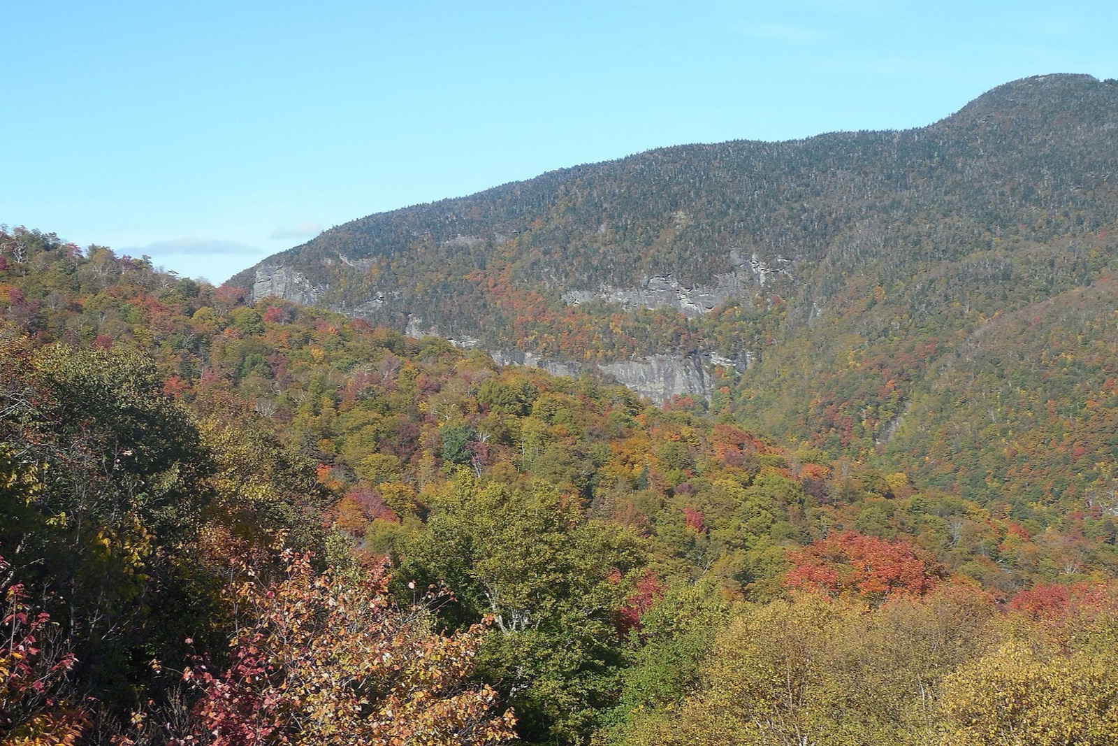
Vermont's sugar maples turn the Green Mountains red and gold, peaking in early-to-mid October along Route 100.
Peak: October 7–October 11
Color builds from September 25 · mostly bare by October 30
Vermont is sampled at 6 weather points, then moved 1 day earlier so the model agrees with 2 published peak dates from almanac.com. This year's weather has the peak running 1 day earlier than a normal year. Peak barely moves inside Vermont, roughly 3 days between the first place to turn and the last. How the forecast works
Known for
Things to do in fall in Vermont
12 iconic stops, including scenic drives, farms, haunts, and the views locals plan their October around.
Smugglers' Notch (Vermont Route 108)
Scenic drivePeak October 8
Route 108 squeezes through Vermont's most dramatic mountain pass, threading hairpin turns beneath 1,000-foot cliffs between Mount Mansfield…
Mount Philo State Park
State parkPeak October 10
Vermont's first state park (1924) tops out at just 968 feet, but a short auto road or one-mile trail delivers an outsized payoff: a…
Quechee Gorge
State parkPeak October 9
Known as Vermont's Little Grand Canyon, this 165-foot-deep gorge cut by the Ottauquechee River is spanned by a US Route 4 bridge with a…
Cold Hollow Cider Mill
Cider millColor nearby peaks October 9
Vermont's best-known cider mill has pressed apples on this Waterbury Center site since 1974, using a century-old rack-and-cloth press…
Shelburne Farms
FarmColor nearby peaks October 10
A 1,400-acre former Vanderbilt-Webb estate on Lake Champlain, now a nonprofit education farm with a working dairy, a cheese-making barn…
Appalachian Gap (Vermont Route 17)
Scenic drivePeak October 8
Vermont Route 17 hairpins up to a 2,369-foot summit between Waitsfield and Bristol, with the Long Trail crossing right at the height of…
Peak October 6
Vermont's only major undeveloped peak (its bare, rocky profile appears on the state seal) rewards a 6.9-mile round-trip hike via the Monroe…
Woodstock Village
Historic townColor nearby peaks October 9
An elliptical village green ringed by Federal and Greek Revival houses, covered and iron bridges over the Ottauquechee River, and a…
Halloween
Guides
2026 Fall Foliage Forecast: When Leaves Peak in Every State
Our 2026 fall foliage forecast for the US and Canada, region by region, built from ERA5 weather data and a phenology model, with live peak dates on the map.
What's New: A Map of 465 Fall Destinations
Autumn Guide's Explore hub now covers 465 spots worldwide (orchards, scenic drives, hikes, and festivals) with category pins, live status, and a near-me search.
The Best Fall Hikes in New England
Eight trail-tested fall hikes across Vermont, New Hampshire, Maine, and Massachusetts, from short overlooks to a full above-treeline ridge walk.
5 Leaf-Peeping Road Trips for 2026
Five real fall road trips for 2026, from Vermont's Route 100 to Germany's Alpine Road, with route feel, standout stops, and how many days to plan for each.
Vermont Fall Foliage: The Complete Guide
Vermont is the state other fall foliage destinations get measured against. Its hillsides carry more sugar maple per acre than almost anywhere else in New England, and its color moves in a predictable north-to-south, high-to-low sequence that rewards travelers who know how to read it. Here's how to plan around that sequence.
Why Vermont Sets the Benchmark
Sugar maple is the reason. Vermont's hardwood forests lean harder on sugar maple than the mixed oak-hickory woods to the south or the birch-heavy stands of the far north, and sugar maple happens to be the most theatrical tree in the Northeast: its leaves cycle through yellow, orange, and a true scarlet red, often on the same tree, sometimes on the same branch. Stack thousands of acres of that density across the Green Mountains and you get hillsides that read as solid color from a mile away, not the speckled patchwork you find in more mixed forests.
It also helps that Vermont has almost no billboards and very little sprawl to interrupt the view. The state's Depression-era brake on roadside advertising, still in effect today, means a drive down nearly any state highway is unbroken forest, farmland, and white-steepled villages. For background on why the leaves do this at all (the pigments, the daylight triggers, the chemistry behind the color change), this explainer is worth a read before you go.
None of this makes Vermont better than its neighbors so much as more concentrated. New Hampshire has bigger mountains and arguably more dramatic notches; the Adirondacks have wilder, less-visited terrain. Vermont's advantage is density and accessibility together: you rarely have to drive far to find the good stuff.
The North-to-South Race
Foliage in Vermont does not arrive all at once. It starts in the Northeast Kingdom (the wild, sparsely populated wedge of the state around Craftsbury, Greensboro, and Lake Willoughby) and rolls south over the following two to three weeks, finishing in the Champlain Valley lowlands and the state's southern tier near Manchester and Brattleboro. October 7–October 11, 2026 (forecast) gives you the current forecast window for the state as a whole, but treat it as a middle point, not a single date: the Kingdom is usually well past peak by the time southern valleys are just getting started.
This lag is why a smart week-long trip works north to south rather than staying in one place. Spend the early days chasing color in the Kingdom or up in the high country around Stowe, then drift south as the weeks pass and let the color follow you down through the Mad River Valley and into southern Vermont. Locals plan trips this way instinctively; visitors who fixate on one town for a week often catch it either too early or past its best.
How Elevation Changes the Math
Latitude explains the north-south lag, but elevation explains why two towns twenty minutes apart can look completely different on the same day. Cold settles into high ground first, so a ridge at 3,000 feet can be at peak color while the valley floor 2,000 feet below is still mostly green. Drive up Route 108 through Smugglers' Notch, or up the auto road on Mount Mansfield, and you can pass through two or three weeks of seasonal progress in a twenty-minute climb.
This is the single most useful piece of local knowledge for timing a trip: if the valleys look like they're a week away, head uphill. If the high peaks already look stripped and brown, that same color has usually just arrived in the valleys below, and you haven't missed anything. You've arrived right on schedule for lower ground. October 7–October 11, 2026 (forecast) tracks the statewide average, so treat higher elevations as running ahead of that number and low river valleys as running behind it.
Route 100 and the Classic Drives
Route 100 is Vermont's foliage spine, running roughly north-south through the Green Mountains and stringing together Stowe, Waterbury, Warren, Waitsfield, Ludlow, and Weston along the way. It's the drive most people picture when they picture Vermont in fall: covered bridges, red barns against gold hillsides, farm stands with cider donuts. It's also, on a peak-color weekend, the most congested road in the state.
The better strategy is to use Route 100 as a spine and branch off it onto the gap roads and shorter loops that cross the mountains rather than running alongside them. Route 17 over the Appalachian Gap, Route 125 through Middlebury Gap past the Robert Frost interpretive trail, and Route 9 across the Molly Stark Trail in the south all deliver a more concentrated, less trafficked version of the same color. For a broader menu of drives across the region, including how to sequence a multi-day loop, this road trip guide is a useful companion.
Stowe and Smugglers' Notch
Stowe is Vermont's best-known base for a reason: it sits at the foot of Mount Mansfield, the state's highest peak, with Smugglers' Notch just up the road as one of the most dramatic drives in New England. Route 108 climbs through the notch between sheer rock faces and huge glacial boulders, narrow enough that RVs and trailers are barred from the route entirely. The payoff is a close-up view of cliffs and color that a wider, faster road couldn't deliver.
Stowe itself has the infrastructure to match its reputation: plenty of lodging, restaurants, and a well-developed recreation path along the West Branch River for an easy, flat walk under color without a car at all.
Reading the Gaps
Vermont's "gaps" are mountain passes, and each one has its own personality. The Appalachian Gap (Route 17) between Waitsfield and Bristol is paved, well-traveled, and offers a genuine hairpin-turn descent with long valley views from a marked overlook near the height of land. Lincoln Gap, just south of it, is Vermont's steepest paved through-road, narrow and unlined in places, closed seasonally, and far less crowded simply because its grade discourages casual traffic. Middlebury Gap, further south again on Route 125, splits the difference: an easy, well-graded crossing that most rental cars handle without any drama.
Both of the steeper gaps cut straight through dense maple stands at elevation, which means they often show color while the valleys on either side are still green, another place where the elevation rule pays off. Drive them slowly, pull off only at marked turnouts, and expect them to feel like one-lane roads even where two-way traffic is technically allowed. None of the gaps have guardrails for most of their length, so they reward an unhurried pace more than a scenic-drive checklist mentality.
Hikes Worth the Climb
Three hikes deliver the state's best above-the-trees views without requiring technical skill. Camel's Hump, near Waterbury, has a bare, rocky summit (it was never developed for skiing) with a 360-degree view that on a clear October day takes in most of central Vermont. Mount Mansfield, the state's tallest, has several route options up its ridge (nicknamed the Chin, Nose, and Forehead for its profile), with the Long Trail tracing the summit ridge itself. Sterling Pond, a short, steep climb from the height of land in Smugglers' Notch, rewards a much smaller effort with a tucked-away alpine tarn ringed in color.
All three get busy on fall weekends, so an early start matters more than usual: parking lots at popular trailheads can fill before 9 a.m. in peak weeks. This regional hikes roundup covers more options across New England if you want to range beyond Vermont, and this packing list is worth checking before you go, since fall weather at 4,000 feet can be twenty degrees colder and considerably windier than the trailhead.
Before you climb above treeline in October
- Check the summit forecast separately from the valley forecast
- Bring a real layer, not just a fleece: wind at elevation cuts fast
- Start early; popular trailhead lots fill by mid-morning
- Tell someone your route and expected return time
Avoiding the Crowds
Vermont's foliage crowds concentrate predictably: weekends, Route 100 between Waterbury and Warren, and the parking lots at Stowe's and Woodstock's most photographed spots. Shifting your trip to midweek solves most of this on its own: the same roads and trailheads that feel overrun on a Saturday can feel nearly empty on a Tuesday.
The other trick is one locals use without thinking about it: Vermont has an enormous network of unpaved town highways, the same gravel roads people rely on to get around during spring mud season, and in the fall those roads double as a bypass lane around Route 100's worst backups. They're slower and require a bit more attention (washboard surfaces, occasional single-lane bridges), but they run through the same maple stands with none of the traffic, and they're where a lot of Vermont's best unphotographed color actually is.
Where to Base Yourself
Stowe is the obvious choice for infrastructure and central access to Mansfield and the Notch, but it's also the most expensive and most crowded option. The Mad River Valley (Waitsfield and Warren) sits just as centrally on Route 100 with a quieter, more agricultural feel and easy access to both the Appalachian and Lincoln Gaps. Woodstock, further south and east, is Vermont's postcard village and a good base for anyone whose trip skews toward the southern half of the state.
For travelers chasing the earliest color, a base in the Northeast Kingdom (Craftsbury or Greensboro) puts you closest to the season's opening act, though services are sparser and drives to major trailheads are longer. Manchester, in the south, is the better call if your schedule only allows a later trip, since the color arrives there last. None of these are wrong choices; they're really a question of which stretch of the season you're chasing and how much company you want along the way.
Sugarhouses, Cider, and the Harvest Table
It's a common misconception that fall is maple season in Vermont. Sap actually runs in late winter and early spring, when overnight freezes and daytime thaws get the trees flowing, so you won't see steam pouring out of a sugarhouse chimney in October. What you will find is plenty of sugarhouses open for tastings, syrup sales, and farm tours, often paired with the kind of harvest-table meal (squash, apples, cider donuts, maple-glazed everything) that Vermont does especially well in the fall.
Cider mills fill the gap nicely. Orchards around Waterbury Center, the Champlain Valley, and southern Vermont press fresh cider through the season and often sell heirloom apple varieties you won't find in a grocery store. A short stop at a mill or sugarhouse breaks up a long driving day and gives you something to do besides stare at trees, and after a few hours on the gap roads, a warm cider donut is its own reward. If you're planning to photograph any of this, this photography guide covers how to handle the flat, hazy light that's common on Vermont's warmer fall afternoons.
Understand the season in Vermont
Short explainers on why and when the color arrives here.
Photography & Observation
Editing Fall Foliage Photos: A Simple Workflow
A repeatable fall foliage editing workflow: fix white balance, recover exposure, add contrast, and use vibrance instead of saturation so color stays believable.
2026-07-18 · 6 min read
Foliage Timing & Seasons
How Fall Foliage Forecasts Actually Work
Fall color forecasts combine a fixed seasonal trigger with weather that has to be estimated. Here's how the underlying model actually predicts a peak.
2026-07-18 · 6 min read
Leaf Science
How to Identify Trees by Their Fall Leaves
A field method for naming trees by autumn leaves: check the branching pattern first, then leaf shape, then color, and most common species sort themselves out fast.
2026-07-18 · 6 min read
Frequently asked
- When do leaves peak in Vermont in 2026?
- Peak color is predicted for October 7–October 11 (best estimate October 9). Color starts around September 25 and trees are mostly bare by October 30.
- How reliable is the Vermont forecast?
- The forecast blends recent-year weather normals with photoperiod and elevation; it tightens as the season approaches. Against published peak dates the model lands within a few days for most regions, but it can be a week or more out. Mountains and coastlines are the hardest. Higher elevations turn roughly one day earlier per 300 m.
- When is Vermont's autumn season?
- Vermont is in the northern hemisphere, so its color season is autumn (September to November). The turn takes roughly 35 days end to end, centered on October 9, and the last 12 of those are thinning canopy rather than color.
- What are the best things to do in fall in Vermont?
- The iconic stops: Smugglers' Notch (Vermont Route 108), Mount Philo State Park, Quechee Gorge, Cold Hollow Cider Mill, Shelburne Farms, Appalachian Gap (Vermont Route 17). Every one is mapped on this page with its peak-color timing.
- When does foliage peak in Vermont?
- It depends on where you're standing. The Northeast Kingdom's high ridgelines usually turn first, in late September, while the Champlain Valley and Vermont's southern county lines often hold color into mid-October. Elevation shifts the calendar as much as latitude does, so a single week can hold bare ridgelines above and green valley floors below.
- Is Route 100 really the best drive?
- It's the most complete one, since it strings together the Green Mountains' spine from the Northeast Kingdom down through the Mad River Valley to the southern resort towns. If you only have a day, a shorter loop off Route 100, over one of the gap roads, usually delivers a denser dose of color.
- Should I visit on a weekend?
- Only if you have no choice. Weekend traffic on Route 100 and around Stowe can turn a scenic drive into a parking search. Midweek visits, especially Tuesday through Thursday, give you the same trees with a fraction of the cars, and lodging is easier to find on short notice.
- Are the mountain gap roads open in the fall?
- Usually, but check ahead. Lincoln Gap and the higher stretches of Smugglers' Notch can close early if an autumn storm brings snow or ice to the summit, and Lincoln Gap closes for the season well before winter regardless. A little early-morning frost is normal and not a reason to cancel.
- Do I need to time my trip around sugarhouses?
- No. Maple sugaring happens in late winter and early spring, not fall, so you won't see steam rising from a sugarhouse in October. Many still open for tastings, syrup sales, and pancake breakfasts during foliage season, and pair naturally with a stop at a cider mill.
Nearby & similar
Season by season
2026 (forecast)
Peak October 7–October 11
September 25 → October 30