Appalachian Gap (Vermont Route 17)

Scenic drive · Vermont
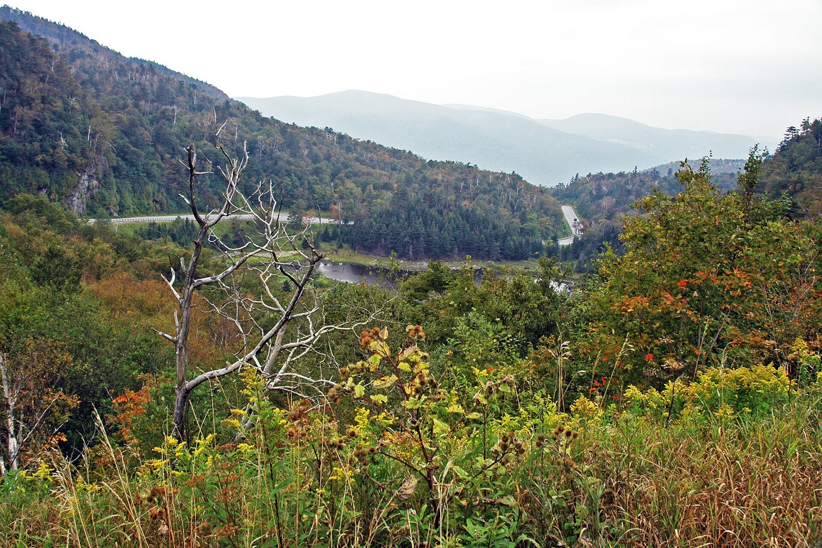
Appalachian Gap (Vermont Route 17) in Vermont
Photo: James St. John / Wikimedia Commons, CC BY 2.0

Vermont Route 17 hairpins up to a 2,369-foot summit between Waitsfield and Bristol, with the Long Trail crossing right at the height of land. Roadside pull-offs open onto the Champlain Valley and the Adirondacks beyond, on one of the state's steepest, most scenic fall drives.

Best for: Steep, scenic Green Mountains crossing

Don’t miss

  • 2,369-foot summit crossing
  • Long Trail crosses at the height of land
  • Views to Lake Champlain and the Adirondacks
2026 Forecast

Peak: October 7–October 11

Color builds from September 24 · mostly bare by October 30

Color starts: September 24Peak: October 9Bare: October 30AugustDecember

Method: daily ERA5 temperatures drive a photoperiod + chilling phenology model, sampled at Appalachian Gap (Vermont Route 17)’s own coordinates and elevation (728 m) rather than a regional average. Estimates, not promises — check locally before you plan a trip around it.

Appalachian Gap (Vermont Route 17) on the map

More things to do in Vermont

Smugglers' Notch (Vermont Route 108)

Scenic drive

Peak October 9 2026 forecast

Route 108 squeezes through Vermont's most dramatic mountain pass, threading hairpin turns beneath 1,000-foot cliffs between Mount Mansfield and Sterling Peak. The 3.5-mile stretch between Stowe and Jeffersonville closes each winter and peaks with maple and birch color in early-to-mid October.

Don’t miss: Hairpin turns beneath Mount Mansfield · Height-of-land parking area for short hikes · Closes mid-October to mid-May

Mount Philo State Park

State park

Peak October 12 2026 forecast

Vermont's first state park (1924) tops out at just 968 feet, but a short auto road or one-mile trail delivers an outsized payoff: a sweeping view over the Champlain Valley's turning maples to the lake and New York's Adirondacks beyond.

Don’t miss: Vermont's oldest state park · Short auto road to the summit · Views across Lake Champlain to the Adirondacks

Quechee Gorge

State park

Peak October 11 2026 forecast

Known as Vermont's Little Grand Canyon, this 165-foot-deep gorge cut by the Ottauquechee River is spanned by a US Route 4 bridge with a pedestrian walkway, framed by red maples that make it one of the state's most-photographed fall stops.

Don’t miss: 165-foot gorge viewed from the Route 4 bridge · Trails down to the river · Adjacent campground and gift shops

Cold Hollow Cider Mill

Cider mill

Color nearby peaks October 11 2026 forecast

Vermont's best-known cider mill has pressed apples on this Waterbury Center site since 1974, using a century-old rack-and-cloth press visible through viewing windows. The bakery's cider doughnuts and gallons of fresh sweet cider draw a steady line of leaf peepers off Route 100.

Don’t miss: Working rack-and-cloth cider press · Fresh cider doughnuts · Farm store with Vermont products

See all things to do in Vermont

Frequently asked

When does Appalachian Gap (Vermont Route 17) peak in 2026?
Peak color is predicted for October 7–October 11 (best estimate October 9). Color starts around September 24 and is mostly bare by October 30.
What is Appalachian Gap (Vermont Route 17) best for?
Steep, scenic Green Mountains crossing.

Own or manage Appalachian Gap (Vermont Route 17)? Update your listing or get in touch.